
-
1341 - Looking back at Pico Turquino


Looking back with one of Perseverance's zoomable mast cameras (max zoom). This mosaic uses two overlapping images and shows the rover's wheel tracks made when it visited the science waypoint at Pico Turquino. The images were acquired on Sol 1341 from site 62.1840 just before 1 pm local mars solar time, from a distance of ~190 meters / 208 yards). For scale the wheel tracks measure ~3 meters / ~9.5 feet across. Image credits NASA/JPL-Caltech/ASU/MSSS
-
1339 - Another drive

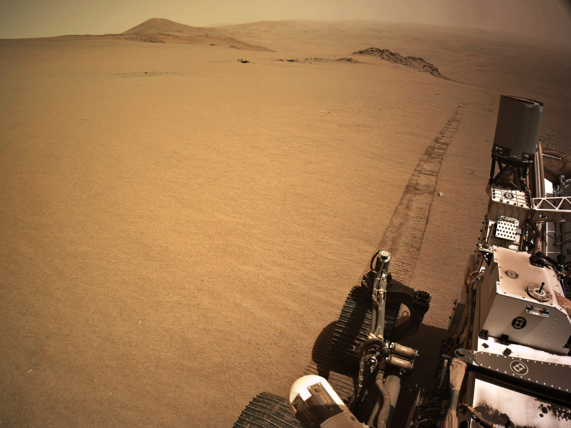
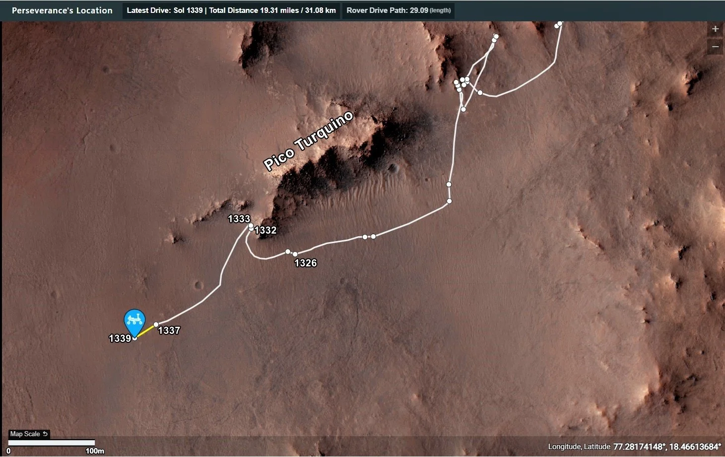
Perseverance rover drove again on Sol 1339, continuing its long climb towards the rim of Jezero crater. The drive took it further towards the southwest, the drive distance was 29 meters (95.4 feet). During the drive it climbed almost 4 meters (~13 feet). The attached imaged is a crop assembled from 4 post-drive navigation camera tiles, the tiles were acquired at site 62.1840. Image credits: NASA/JPL-Caltech.
-
1338 - Drive - Pico Turquino is in the rearview mirror. Onwards and Upwards

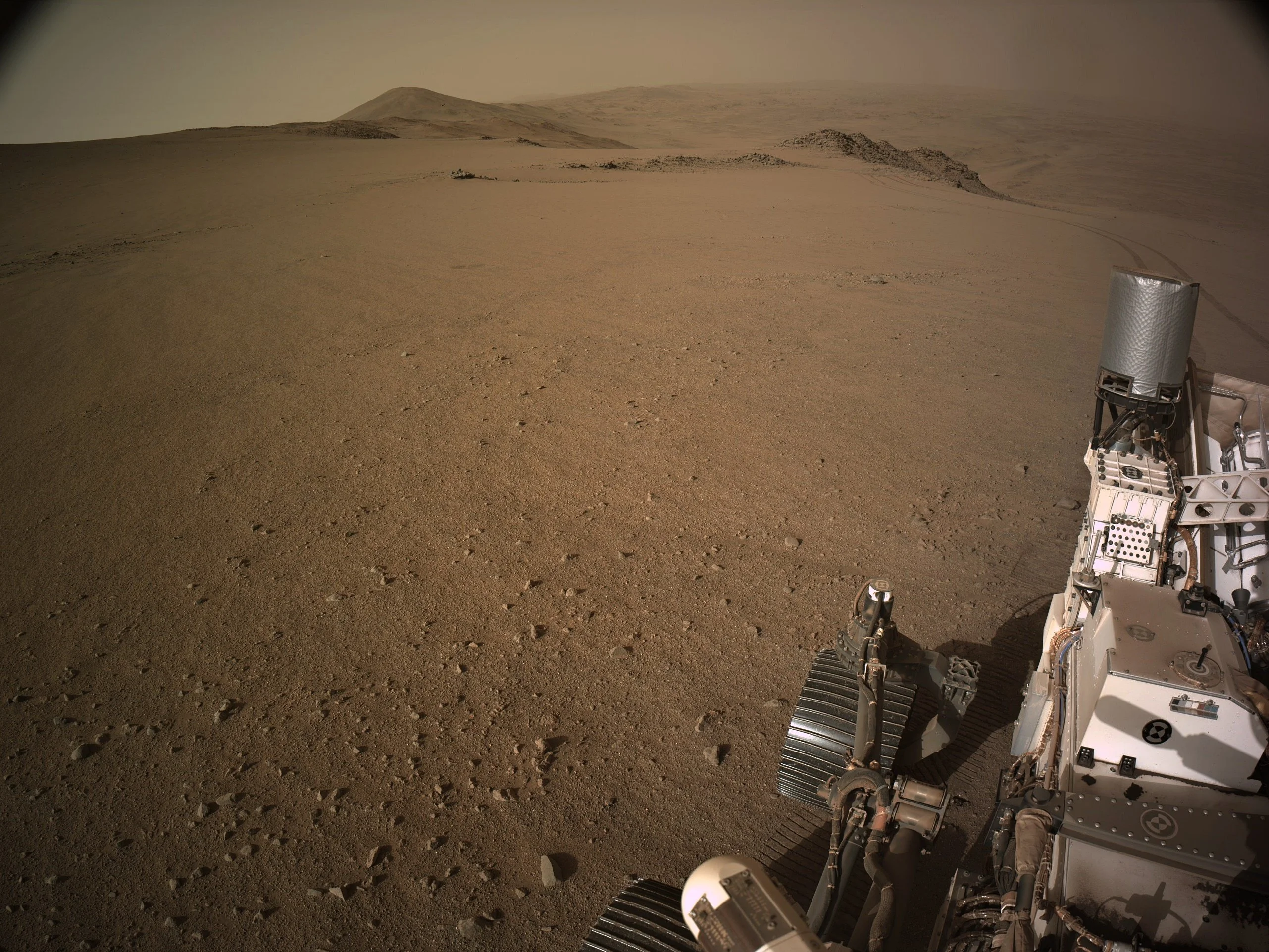
Perseverance rover has driven away from Pico Turquino (see image), and is continuing its climb towards the rim of Jezero crater. It performed contact science there, but no core was taken.
Onwards and upwards!
Image is a roughly processed end-of-drive NavCam from site 62.1666 acquired on Sol 1338.
Credit: NASA/JPL-Caltech
-
Mars Guy - Episode 190 - Mars discovery is flipping the script
YouTube Video
Click to view this content.
Episode one of Separated at Birth? was made 16 months ago after Perseverance discovered a rock that challenged scientific thinking about Jezero crater. Now Perseverance has made an even more disruptive discovery.
-
1334 - Hints of Ansel Adams

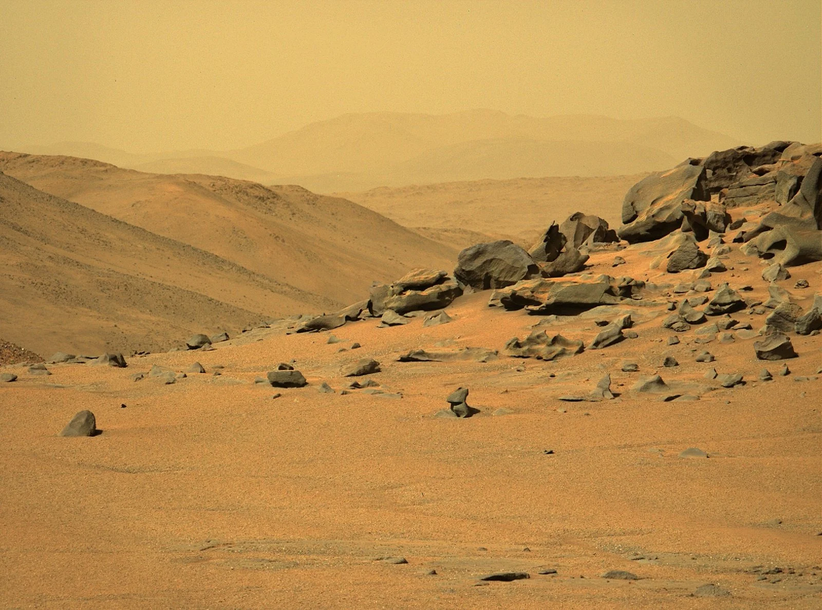
MastCam-Z full zoom (110 mm) - Roughly processed - Contrast stretched. Normally I'd be sighing about the increased level of atmospheric dust we're seeing recently, but in this case it sort of improves the image.
I reckon Ansel Adams would have been happy with this shot.
NASA/JPL-Caltech/ASU/MSSS
-
1334 - Close up of the abraded patch (5cm diameter)

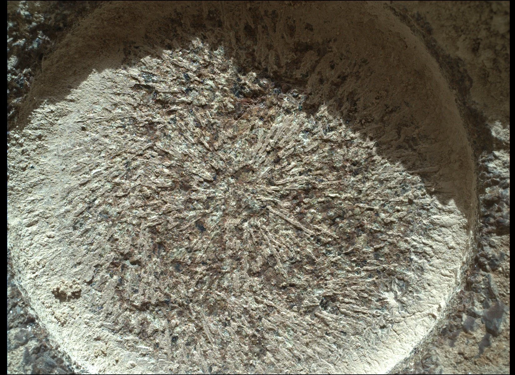
NASA's Mars Perseverance rover acquired this image using its SHERLOC WATSON camera, located on the turret at the end of the rover's robotic arm.
This image was acquired on Nov. 20, 2024 (Sol 1334) at the local mean solar time of 16:26:38.
Image Credit: NASA/JPL-Caltech
-
1334 - Abrasion at the Pico Turquino outcrop


4-tile Left NavCam - For scale the abrasion patch has a diameter of 5 cm (2 inches)
NASA/JPL-Caltech
-
1333 - Short drive to some exposed bedrock


End of drive NavCam - NASA/JPL-Caltech
I assume we'll see some contact science here :)
-
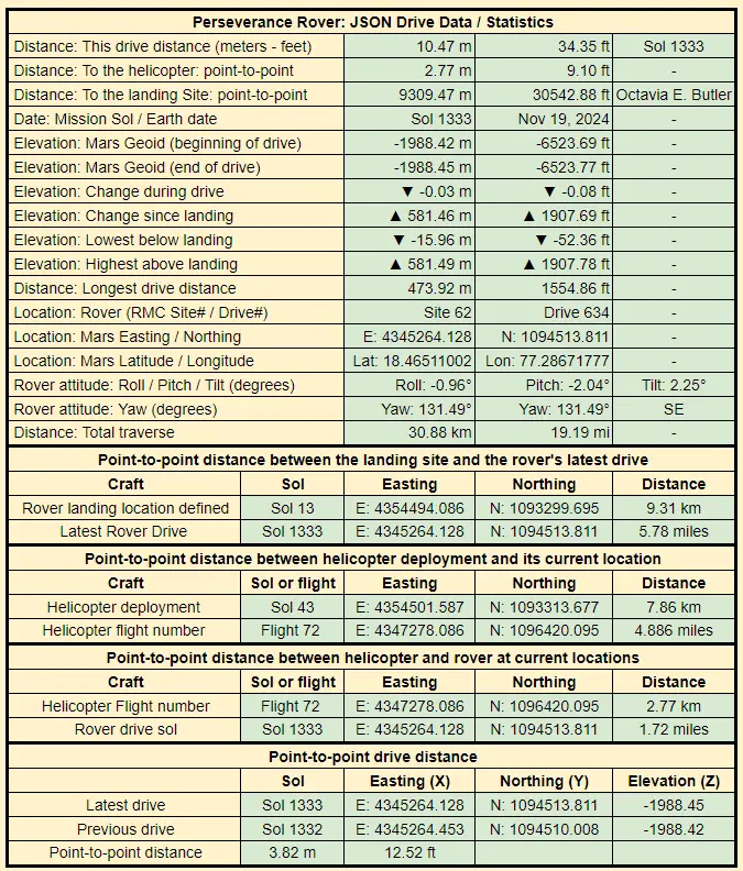
1332 - drive data


Rover data JSON: https://mars.nasa.gov/mmgis-maps/M20/Layers/json/M20_waypoints.json
-
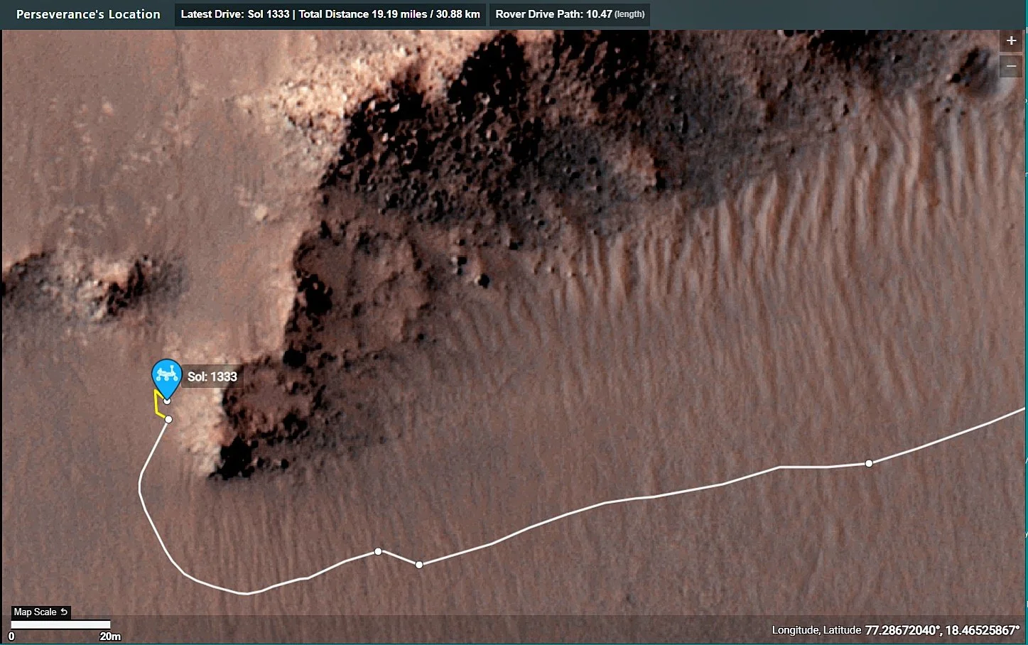
1332 - Traverse Map (the path of the drive is highlighted in yellow)

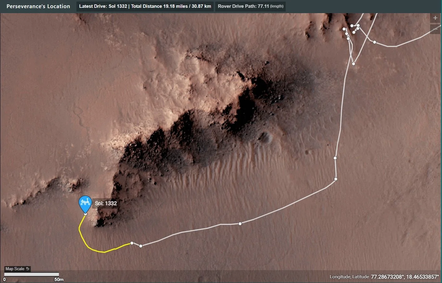
View the official on-line version on https://mars.nasa.gov/maps/location/?mission=M20/
-
1332 - Another drive - Arriving on the western side of Pico Turquino

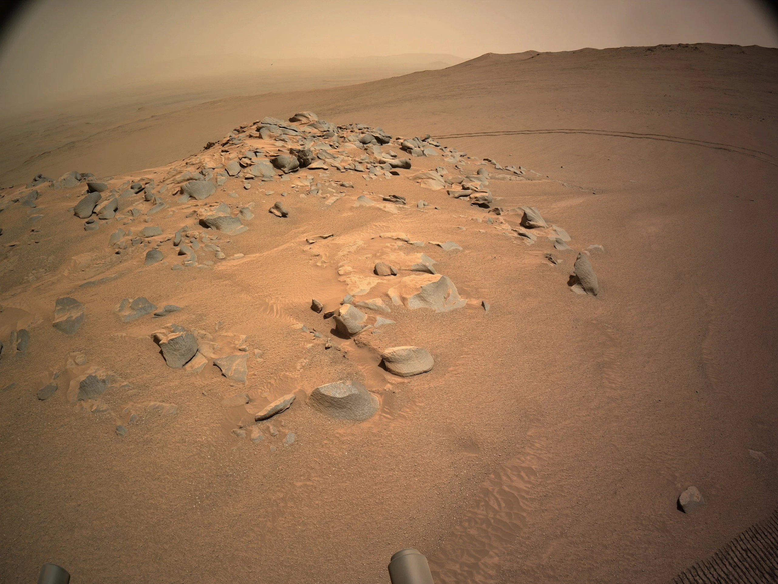
After the 8.9 meters drive on 1327, there was another drive on 1332 of around 50 meters (point-to-point distances). Neither of these drives have been included on the official map, or included in the latest rover JSON URL. I'm assuming that this is related to the job losses announced at JPL earlier this week (>300 jobs lost)
-
Mars Guy - Episode 189
YouTube Video
Click to view this content.
Impact craters can expose the subsurface in a way that no rover is equipped to do. So the biggest crater accessible to Perseverance in many months looked like a good exploration target, until it disappeared from view.

