-
Growth of the Habsburg Dominions

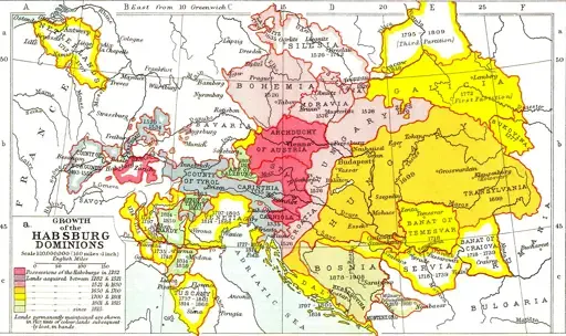
Source: https://commons.wikimedia.org/wiki/File:Growth_of_Habsburg_territories.jpg
Map was made in 1910, and the monarchy collapsed in 1918. At its creation it wasn't a historical map, it was showing the history of a still existing and thriving entity.
-
USA map showing the relative mix of red/blue by state

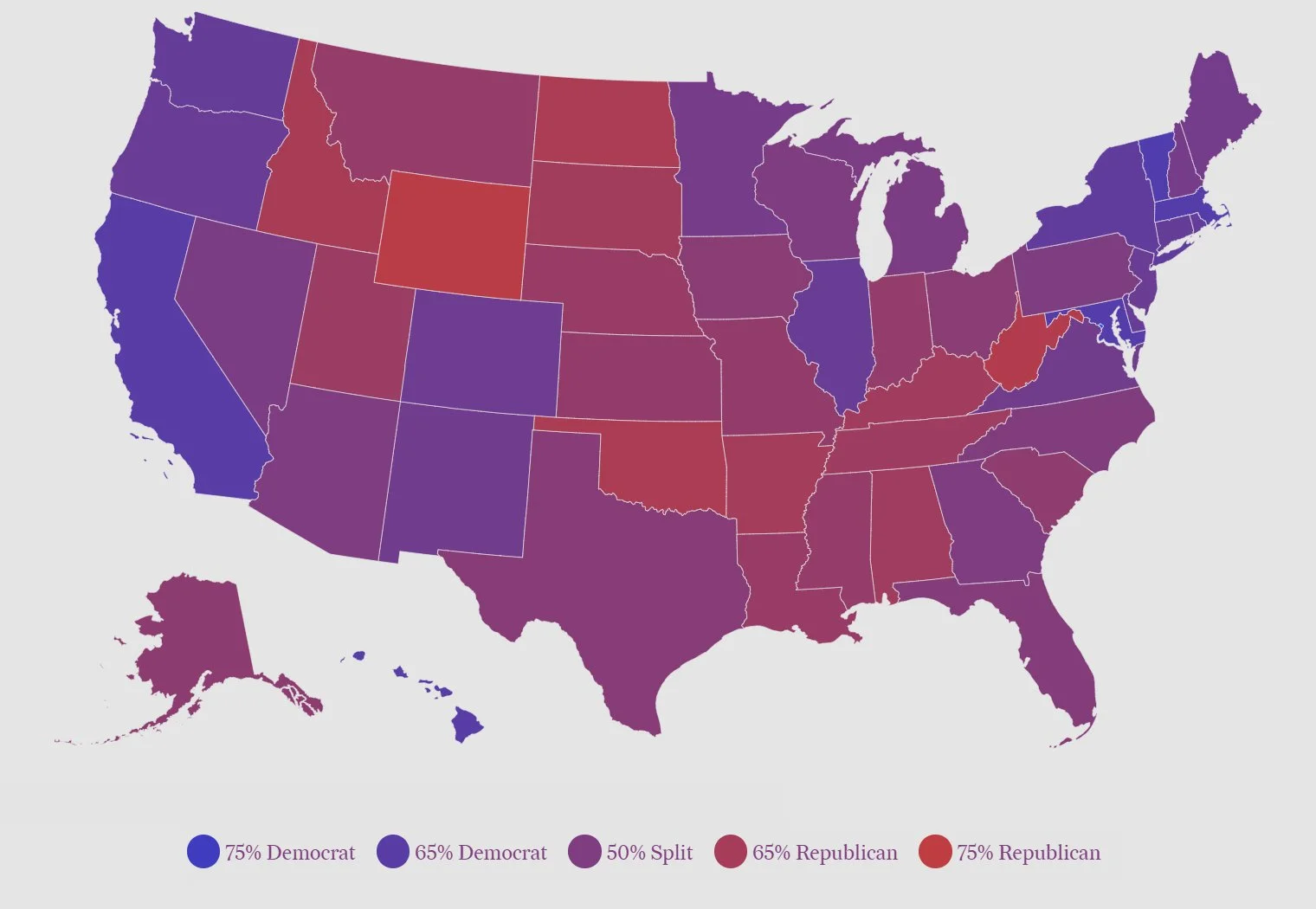
Compared to constantly seeing the "winner takes all" election result maps, I think this type of map is a good reminder that a strong diversity of opinion exists in most states.
-
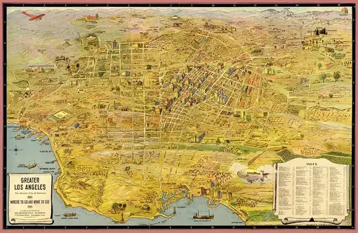
Vintage Map of Greater Los Angeles 1932

cross-posted from: https://lemm.ee/post/47534442
> cross-posted from: https://lemmy.world/post/22092605
-
Handedness of rail traffic: left hand and right hand operation world wide.

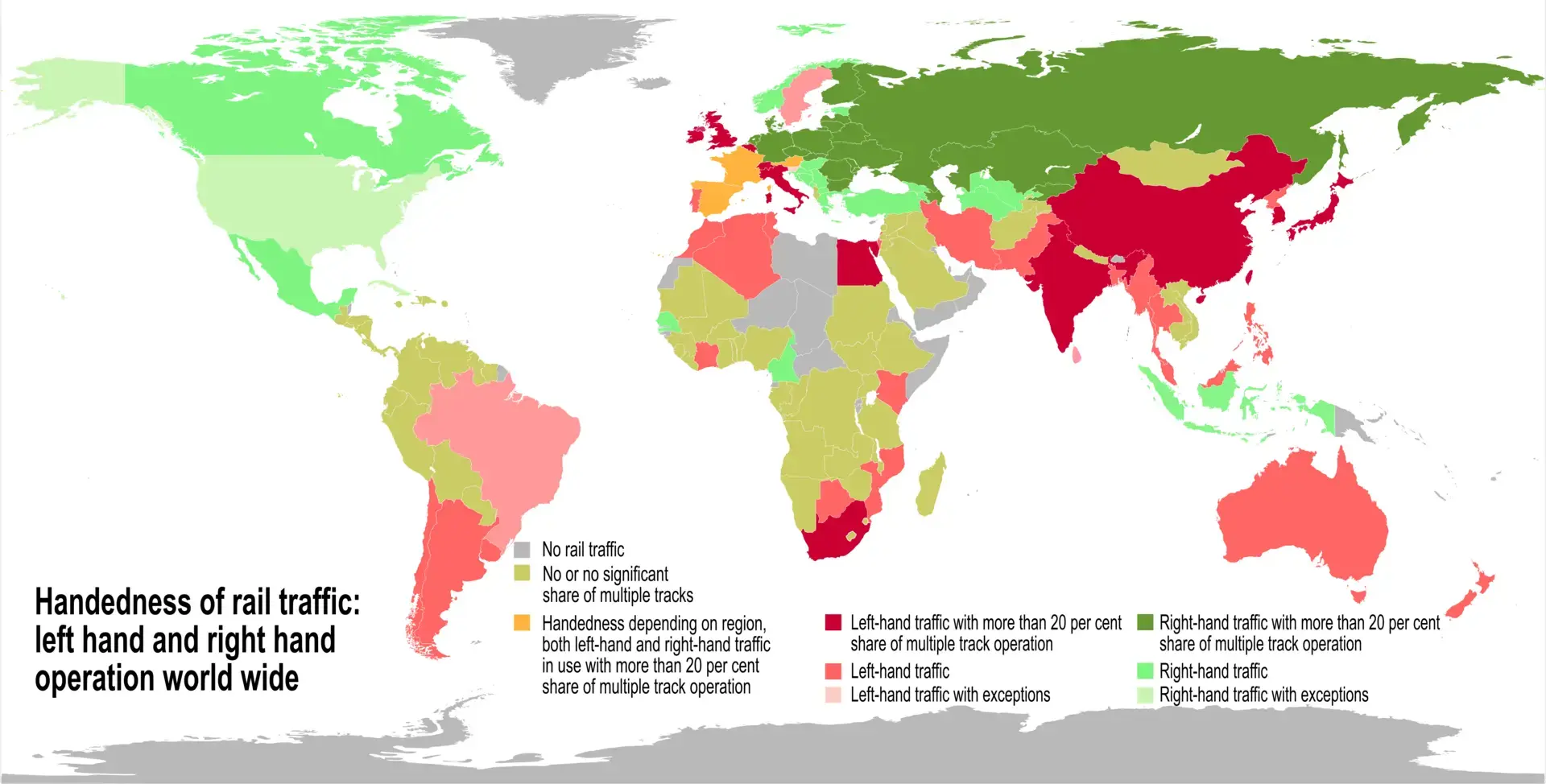
Not visible in the map, but interesting to note, is that in France the trains normally drive on the left, except in Alsace where they drive on the right as a legacy of the time the province belonged to Germany.
-
The EIU's 2023/24 democracy index

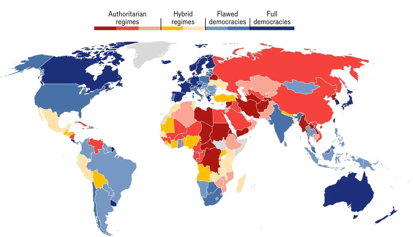
https://www.eiu.com/n/democracy-index-conflict-and-polarisation-drive-a-new-low-for-global-democracy/
-
A map of Aravalli, one of the oldest mountain chains in the world (1.8 billion years) - Perrin Remonte


https://www.perrinremonte.com/fraccueil-1
-
Europe divided into regions of 1 million people


cross-posted from: https://discuss.tchncs.de/post/24398649
> Credits: https://old.reddit.com/r/dataisbeautiful/comments/1gefa5y/europe_divided_into_regions_of_1_million_people_oc/
-
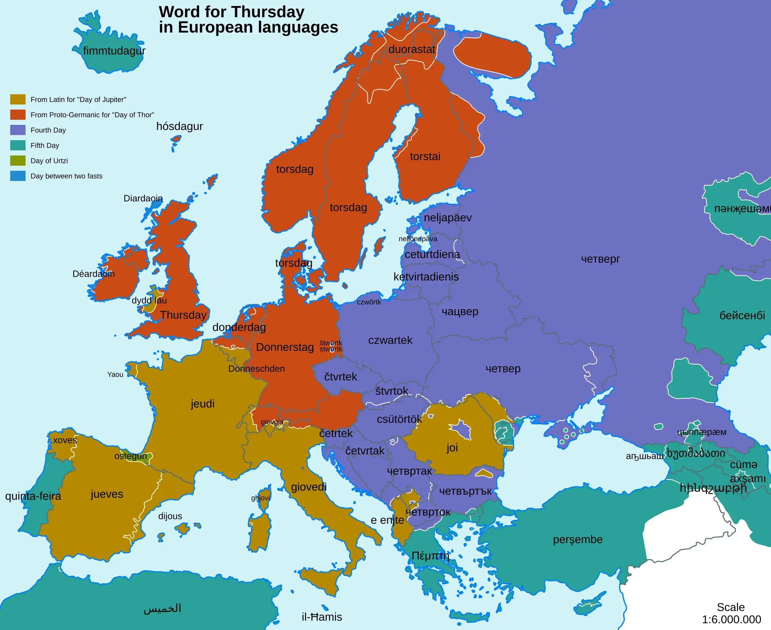
Word for Thursday in European Languages
Source: https://commons.wikimedia.org/wiki/File:Word_for_Thursday_in_European_Languages.svg

